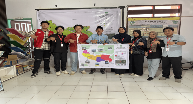
Maros, July 24, 2025 — The National Community Service Program (KKN Kebangsaan) team from Tanjungpura University (Untan) has implemented a program titled "GeoDesa Jenetaesa: Administrative Mapping of Jenetaesa Village". The initiative aims to update the administrative map of Jenetaesa Village, Simbang Sub-district, Maros Regency, South Sulawesi.
Running since July 14, 2025, the program successfully revised the village's administrative map by including a newly formed hamlet that was previously omitted from the old version. The updated map was officially installed at the Jenetaesa Village Office on July 24, 2025, and will serve as a vital reference for village governance, spatial planning, and public services.
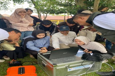
“We aimed to provide a more comprehensive and accurate map reflecting the current conditions. The update process involved field surveys, administrative boundary verification, and coordination with local officials,” explained Ardiansyah, the student in charge of the program.
Jenetaesa Village Head, Abdul Latif, warmly welcomed the outcome. “We are truly grateful for the students’ support. This map is crucial for planning our development programs and managing the village’s potential,” he said.
With this new map, the village administration now possesses more accurate spatial data to support targeted, transparent, and inclusive development.